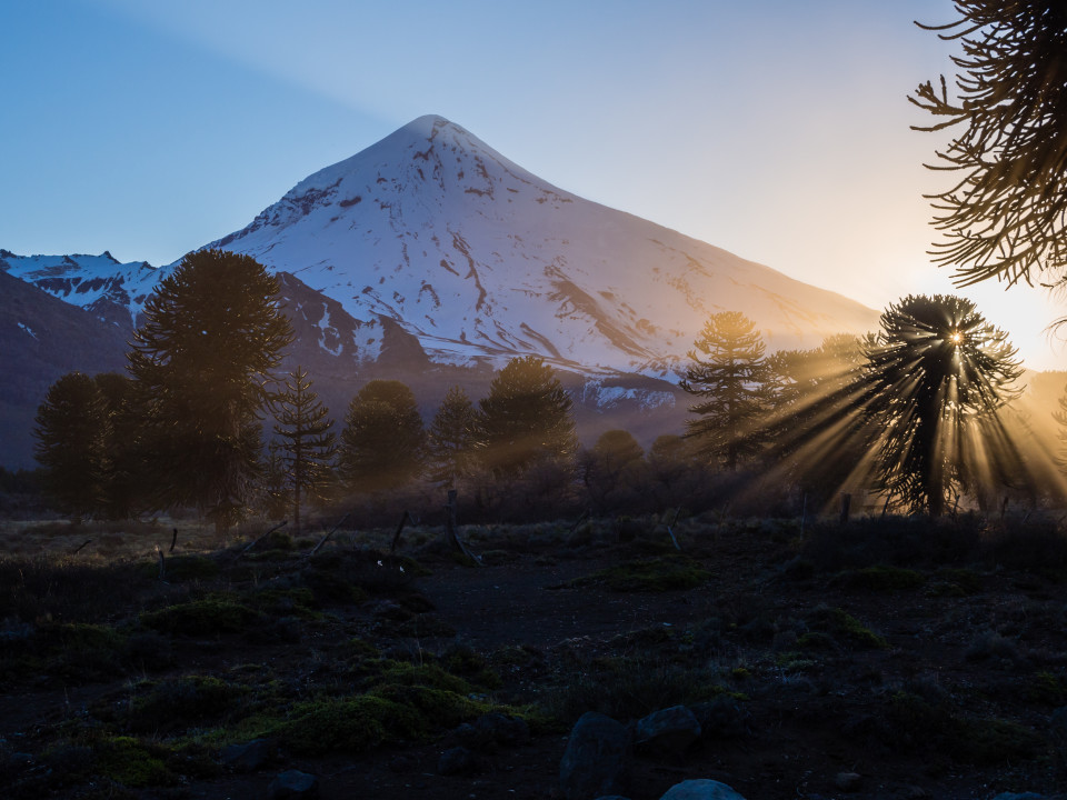
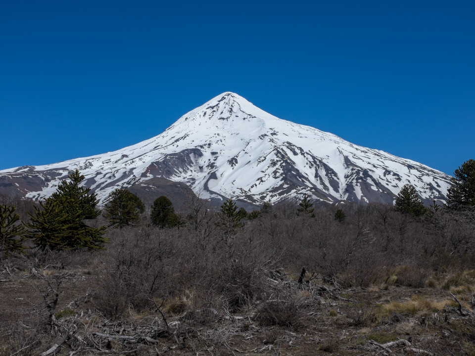
Lanín. An ice-clad, cone-shaped stratovolcano on the border of Argentina and Chile. It stands with an elevation of around 3750M, well above all other peaks in the surrounding area. With its base at under 1200M, it requires almost 2600M of climbing to make the summit. Usually the summit is climbed in two days with parties stopping at the more popular RIM military refuge or a bit further at the CAJA refuge. It can also be done as a very long day trip. This peak stood out for me when I’d started doing research for my trip, I wanted to ski it! Its elevation was the main draw, but additionally, the lack of comforts made it a more compelling objective. Many of the other volcanoes in the area had small ski resorts on their slopes, tempting you to buy a ticket and shave meters off the climb to the summit. No lifts on Lanin. No beer in the huts.

Lanin
By heading down south to El Chalten when I did, I was gambling with my opportunity to summit Lanin. I left for the south during the first period of weather that was decent enough to comfortably and safely make the summit and ski down in the weeks since I’d been thwarted by bad weather as part of a guided trip. The variables I was rolling around in my head: with limited days remaining, by doing Lanin then, I was potentially losing the opportunity to explore southern Patagonia in good weather; the path back to Lanin (and Villarrica, and Llaima) matched up perfectly with a good route back to Santiago; the weather could be even warmer and better in early Oct than now (or it could be worse).
I rolled the dice.
Sitting with Paul in a restaurant in San Martin de los Andes on Thursday, Oct 3rd, discussing our plan for the trip, it looked like the dice had landed in my favour. We were going head out the following morning to do the trip in the typical two day format: climb to the hut on day 1 and then climb to the summit and ski back to the base on day 2. However, while the weather for Saturday, Sunday, and Monday was looking pretty stellar, Friday was going to be crap. We had made another gamble — do day 1 in crappy weather to try to avoid insane crowds on a perfect Saturday and Sunday.
Day 1 – To the Hut
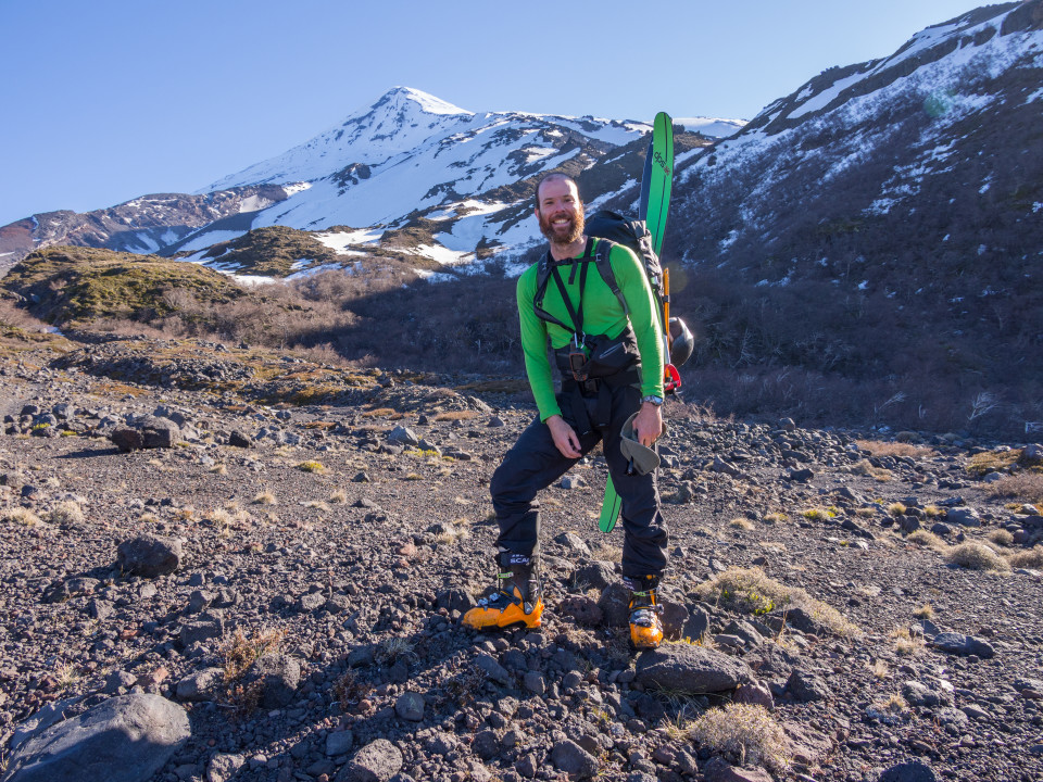
We didn’t get a particularly early start on Friday, we didn’t need to. The forecast suggested the weather might improve as the day progressed, so we took our time. As we approached the base of Lanin from the road, once again, most of the volcano was shrouded in clouds. In my three times driving by, I’d yet to see it up close. We parked the 4Runner at the Tromen ranger station around 11AM. We did the final organization and checks of our gear while waiting for the rangers to show up. A VHF radio seemed to be the key piece of gear they wanted everyone to have, they didn’t really check the rest; I’d picked one of those up in Bariloche in anticipation of the trip. Based on the crowd at the parking lot, there was going to be at least one other group of six with us at the hut consisting of several Argentinians and a French couple. We were on the trail shortly after noon, a little behind the group of six.
The first part of the trail is fairly flat and boring. It starts to get a bit more interesting once you reach the ‘Fish Spine’ ridge. Following that for a while, we eventually dropped down a short bit to snow just below the ridge and started to skin. We were in the middle of the other group at that point. Their lead, a French snowboarder was blazing up the slope next to the spine while several boot packing boarders were trailing behind us. We made our way up in the wake of the French boarder. However, his skin track was rather steep so I opted for a less demanding angle.

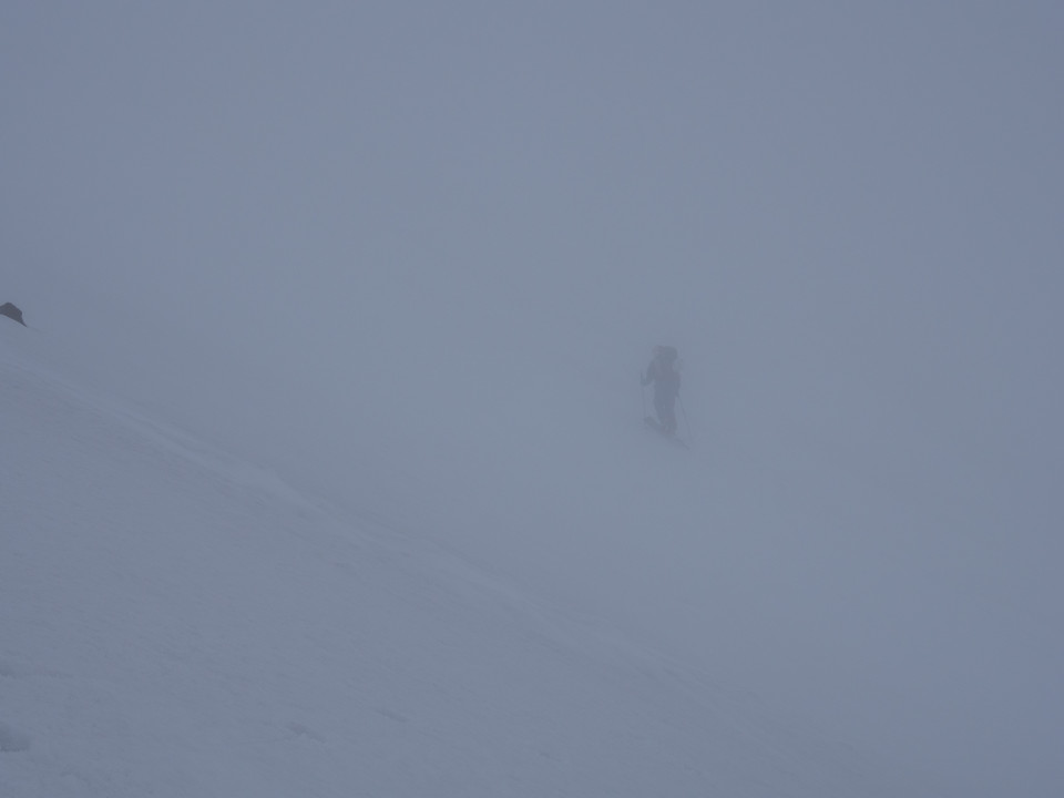
No visibility on the way up
We ascended into the clouds and lost our visibility pretty quickly. Most of the time it wasn’t possible to see more than a few tens of meters ahead. I wasn’t too concerned as the instructions from the ranger seemed straightforward — follow the summer trail until near the end of the fishbone and then veer off from the mule trail and skin straight up the slope towards the hut. We thought we’d heard the ranger say that the hut we were heading for was at 2400m, making it almost a 1300m day. I was watching our elevation on our GPS as we progressed and there was still several hundred meters to go. We took a break at a fairly obvious spot where the other group was also syncing up with their members. After a few minutes, we continued on: forward, forward, turn, forward, forward, turn, head towards the gap in the rocks, hut!? What? It’s too soon. Apparently we’d either heard the elevation wrong or the GPS was wrong. Either way, we skinned right to the hut. It was only 3:30. No complaints, more time to relax out of the wind, wet, and cold.
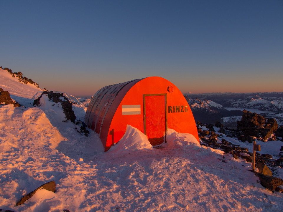
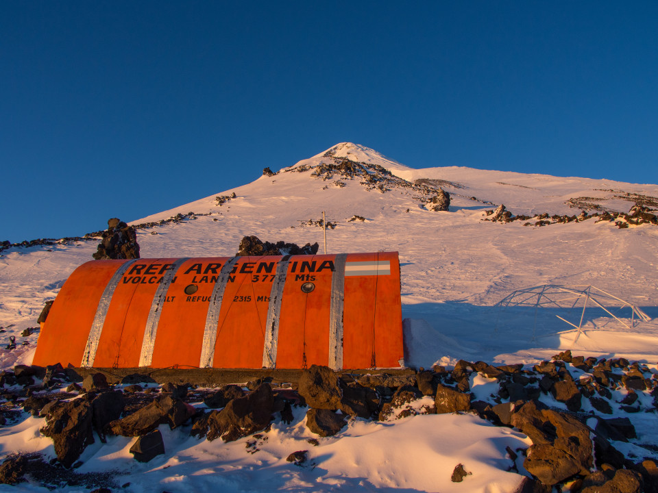
The RIM hut (actually a military refuge) on Lanin is very minimal. There are no stoves, no heaters, no prepared food, no beer, just a roof and a concrete floor. Oh to be at Frey hut right now, just kidding, it’s part of the adventure. Paul and I said hello to another couple that had already arrived and setup their space at the far end of the hut. We plopped our bags down nearby and found a box to sit on. The other group of six had also started filing in. Pretty quickly, everyone was busy sorting through their bags, hanging wet gear on the drying lines, putting on down jackets, and getting themselves cosy.
 Nalegen")
Contemplating life over berry tea in a (BPA free!) Nalegen

Paul also lost in thought

Inside the hut, everyone spacing out. Photo courtesy of Paul.

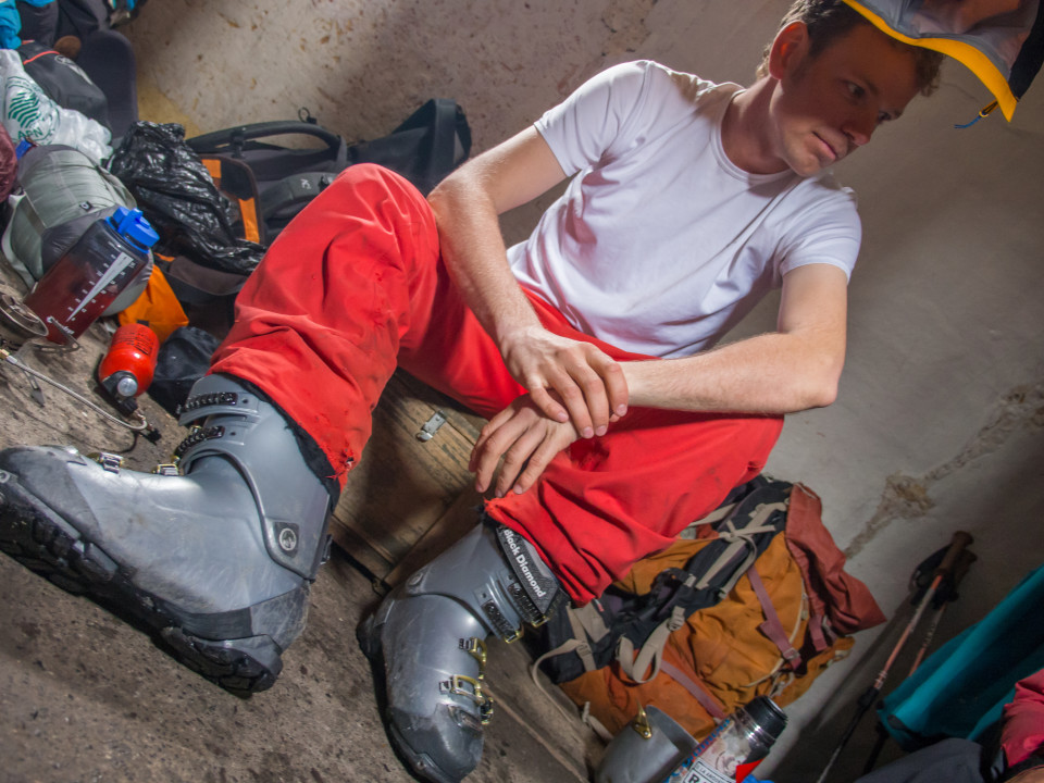
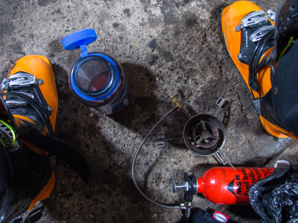
Boots, bottle, stove
There wasn’t much to do. I made some tea, I melted snow to rehydrate and fill water containers. There was a bit of chit chat between groups and within the groups. Everyone looked tired but it was too soon for sleep. I fiddled with my camera and spaced out for a bit. Soon enough, it was time to prepare dinner. I’d picked up a package of tortellini at the grocery store and was going to experiment by adding some cheese and onion flavoured polenta. Dinner of champions, yum, yum! It was edible and filled us up. A few sips from my flask of Wild Turkey bourbon and it was time to start getting the beds ready. With my mattress inflated and sleeping bag out, I spaced back out again for awhile before eventually making the final moves to bed.
Day 2 – Summit
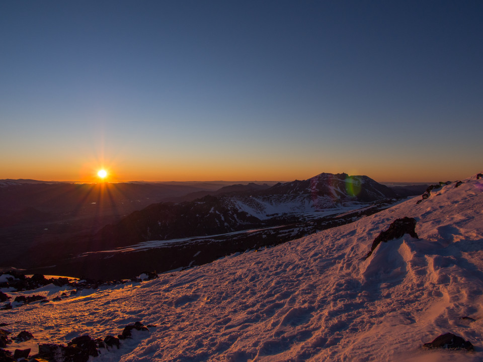
I missed the sunrise! Crap! I was awake before it. I dozed off, and came back to with one of the Argentina girls motioning to go outside. I scrambled to get my boots on and head out the door but the full circle of the sun was already past the horizon. Ah well, it was still great light to take some pictures. And, more importantly, the wind, the wet, and the cloud from yesterday was gone! The weather was looking AMAZING. My next career? Professional gambler! But first, some food. For breakfast, I made oatmeal and tastied it up with a bit of chocolate. Over breakfast conversation, I discovered that I’d been the loudest snorer in the hut. I thought the other two on either side of me were loud, yikes! Normally I don’t snore at all, but that night I sounded like a chainsaw, sorry guys!

Hello sunshine

Entrance of the hut in morning light

Hut with peak in behind. It looks so close!

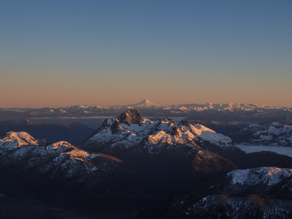
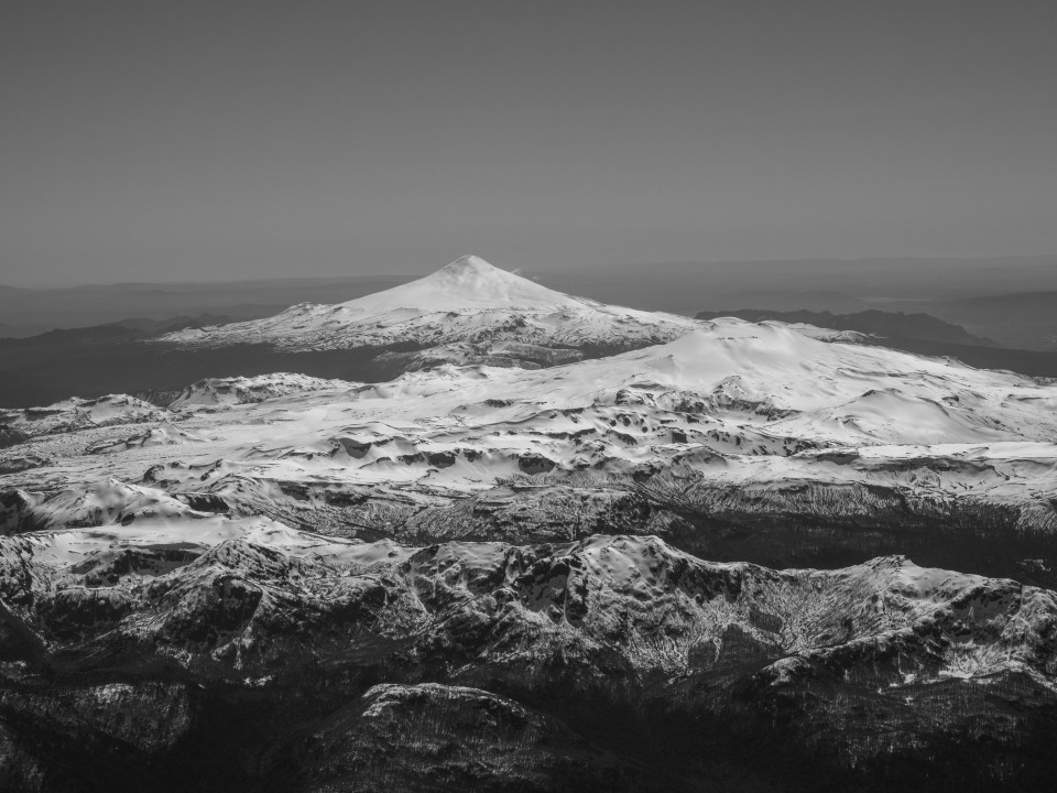
Volcan Llaima in the morning light
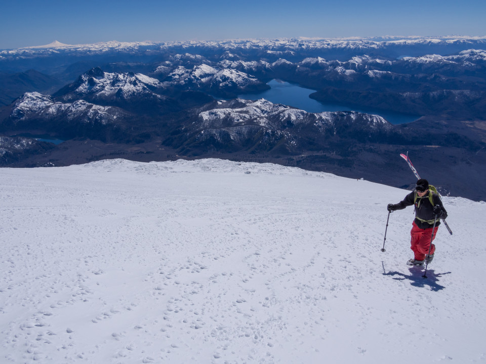
We were off towards the summit by 9AM. I ended up fiddling with my gear and taking some time to use nature’s facilities. Paul forged ahead with the intent that I’d eventually catch up. After our progress yesterday with the full overnight packs, I was confident that the 1500m climb to the summit would go relatively quickly. Initially, the progress was living up to my expectation. We were around half way up the day’s climb (at 3000m) in good time and I’d caught back up.

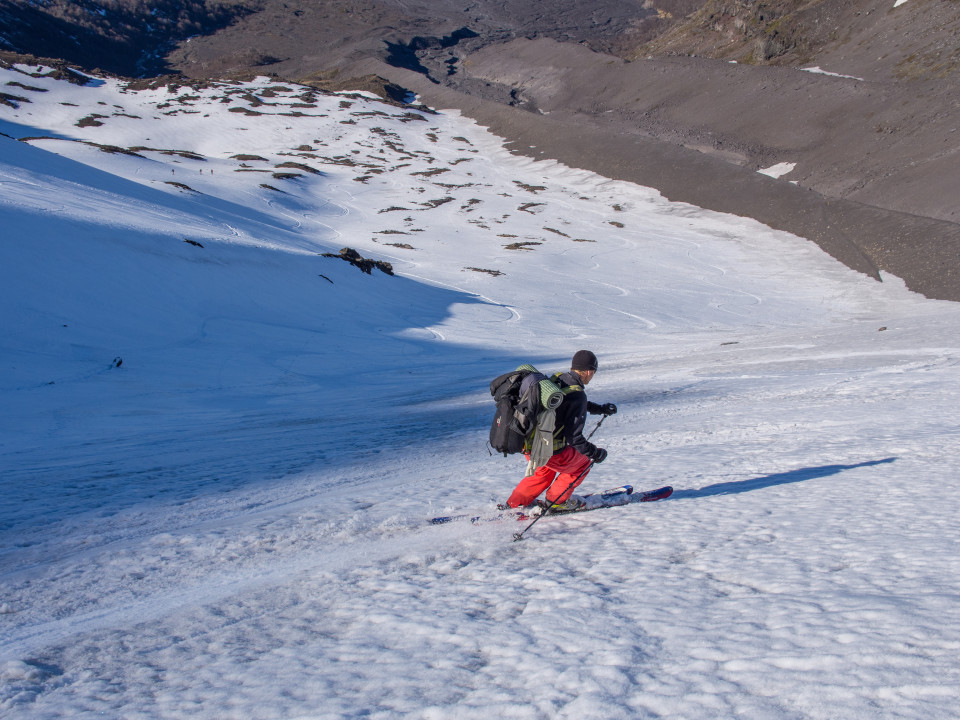
Me skinning

Paul switched to boot crampons
At some point after 3000m, after switching from skis to boot crampons, I really slowed down. This was new elevation territory for me. I’d never spent any time above 3000m and I’d definitely never done any physically intensive activity at this altitude. Normally I like to keep a constant pace for a while, fight the urge to stop until I make marked progress, break, and then continue. I couldn’t do that, I needed to stop much more frequently to catch my breath and let my racing heart slow. Phew! The last 700M was going to take some time.

Me on boots and crampons, slope getting steeper

Paul on one of the steepest parts. The standard route up doesn’t get any more technical than this.
As we marched upward, the surrounding peaks were getting smaller. We were towering above the other volcanoes and mountains in the area. In the second half of the climb, we encountered some other skiers making their way to the summit. They were either doing it as a (long) day trip or had camped somewhere else. I think one of the groups may have started from the Chilean side. The terrain steepened and we marched on. Eventually, we were at what looked to be the last push but the GPS said it was still 150M. The last tenth, it felt like our pace quickened as we pushed to get up that last stretch.
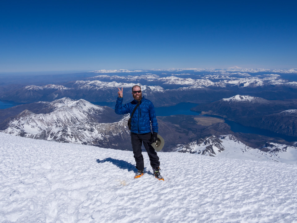
Finally, the last hump was in view. I yanked open the buckles on my ski ladened pack and dropped it on the crunchy snow. Shedding the extra weight, It felt like I bounded up the last few meters to the summit. Either the elevation, physical exertion, or elation was making me feel slightly light-headed.
Lanin!

Paul celebrates

Ross celebrates, Nippon style
Paul and I spent some time taking photos. The French couple — he a boarder, she a skier — were also at the summit with us enjoying and capturing the views.

Zoom of Volcan Villarrica

Enjoying the view with the French boarder

Panoramic view in a different direction
Paul and I spent some time talking to the French boarder about the descent route. The boarder, like Paul, wanted to descend one of the couloirs on the east / north-east aspects of the volcano. We searched for an entrance but didn’t find anything obvious. The French boarder disappeared further down the mountain below a convexity, it looked like he found his entrance. I talked to Paul and told him to go ahead and ski one of those couloirs, I’d be fine skiing back down the route up myself. It’s not very steep and there were still other groups coming up. He tried to convince me otherwise. We went to look at the entrance to the ‘east couloir’ as the entrance looked more accessible than the north-east. It wasn’t winning me over. A nasty entrance through some rocks to a steep 45-50 degree face that had a rocky obstacle requiring a turn before it mellowing ever so slightly to a more sane angle. Just looking at it was psyching me out from skiing at all. I wished Paul good luck and headed back towards the hut.
The first half of my ski down was hell. We’d spent too much time getting to the top and evaluating the route down. The sun had moved off the slope and it had hardened back up. Each turn was knee rattling. It forced many pauses to enjoy the scenery. Finally, below 2800M or so, I hit some softer spring snow and cruised the rest of the way to the hut. Paul was already there from the quicker couloir ski. His report — good thing I didn’t go, it was still quite technical beyond the initial crux. He enjoyed it though, never one to pass up a challenging couloir.
The hut was swarming with people. There were people setting up inside the hut and at least two parties setting up tents outside in anticipation of a full house. Our decision to head up on Friday was a good one. We grabbed our overnight gear and skied down to the base with our full packs. The rest of the ski was enjoyable even with the heavy pack. It ended too quickly and we were back on boots, trudging through the rock and dust towards the car.

Paul enjoying some of the day’s last turns

Back on the dirt, summit to our backs
Getting to the car, the boots came off first. Heaven! I’d never spent so much time in ski boots. Even in the hut I’d kept them on for warmth. My feet looked like they’d been in a bath for two days. We said goodbye to the group of six and headed off towards San Martin. We were going to dine on Lomo and I was going to enjoy a nice bottle of wine to celebrate a successful summit.

Good bye, Lanin!
Well done Ross! Love the story, love the pictures. I miss the mountains so much when I read adventures such as this one. So happy to see you out enjoying the world. Next, you need to come and have some more adventures in this next of the woods. Thinking of you lots….
xxoo
All the way from Singapore,
Jenn
Ross that was a great history, I’m going to the Lanin in the next mouth.. I hope have a beautifull experience like you.
Saludos! Juanma