I decided to visit El Calafate for one reason: to see the big ass glacier. El Calafate and the nearby Perito Moreno glacier are a much more popular destination with the typical tourists than El Chalten. It feels a bit like a southern version of San Martin de los Andes.
On the suggestion from Jacob, I was going to check out the ‘Big Ice’ tour. It was a group tour where you get to walk on the glacier into its midpoint. Jacob warned me that it wouldn’t stand up to the adventure of the past few days, but it was neat none the less. I did a quick google search after I checked into my hotel and it seemed worth doing. There were comments and warnings about it being an intense, ‘physically demanding’ day. Hmmm, we’ll see.
I zipped over to the ticket office to secure my ticket for Monday’s tour. I only had one day to do it as the weather was already turning and I figured it would be best to not spend more days here. I had been keeping tabs on the weather in various areas on a daily basis. It was worsening here but starting to improve near Lanin: a possible summit opportunity! With my ticket purchased, I returned to the hotel, caught up on some e-mail and then headed out to scrounge for dinner.
Big Ice
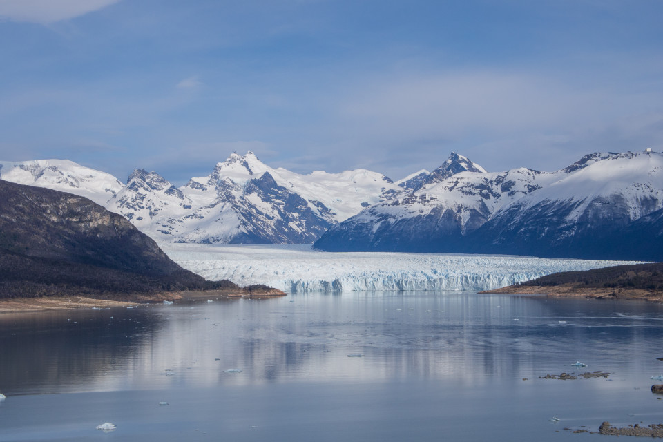
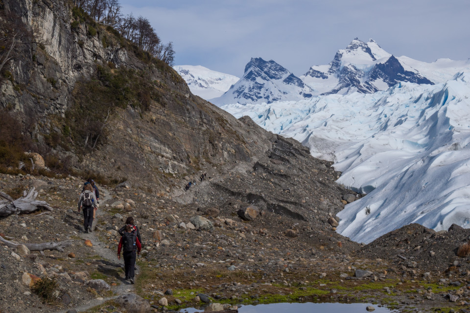
Up at an early hour, I headed downstairs to check out the hotel breakfast. Eggs! Finally, a decent breakfast buffet. I loaded my gear in the car and headed to the port where the tour started. The clouds were starting to move in but it was still bright and pleasant out. I stopped at a viewpoint shortly before the port where the tour started and snapped my first shots of the glacier.

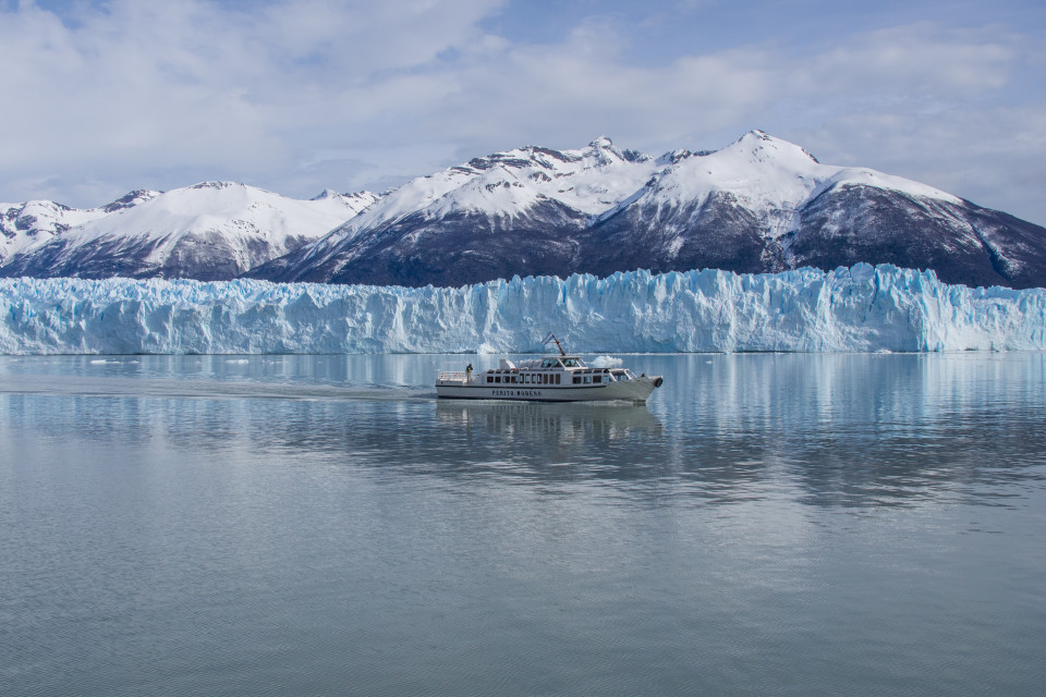
Perito Moreno Glacier
I had a few minutes to kill before the boat was ready to board. This was the first trek I’d been on with this many people. There were around 7-8 in the English group and 10 or more in the Spanish group. I felt a little ‘overdressed’ carrying my own ice axe, crampons, and trekking poles. The boat ride was short but allowed a nice view of the glacier.

Hello other boat!
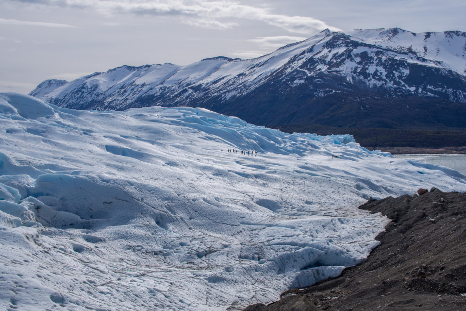
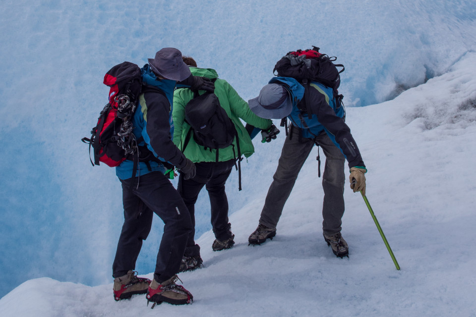
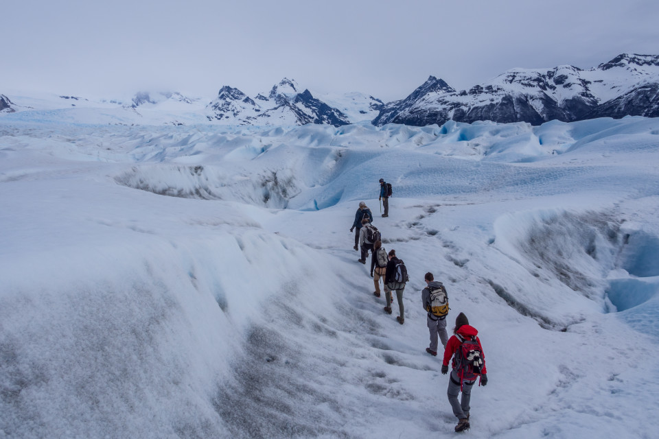
After landing, we gathered at a little refuge and had a quick chat with our guides. We were going to continue to the beach front near the glacier and then onwards on a trail to the point where we’d put on harnesses and crampons. The warnings of ‘physically demanding’ was more ‘physically demanding for those who do no exercise’. It was more of a nice leisurely stroll on a big ass glacier than a demanding trek. I would have preferred for a faster pace and to get further than the mid-point of the glacier. However, the pace did allow plenty of time to take lots of nifty pictures.

Up close to the front face of the glacier

Another group glacier walking

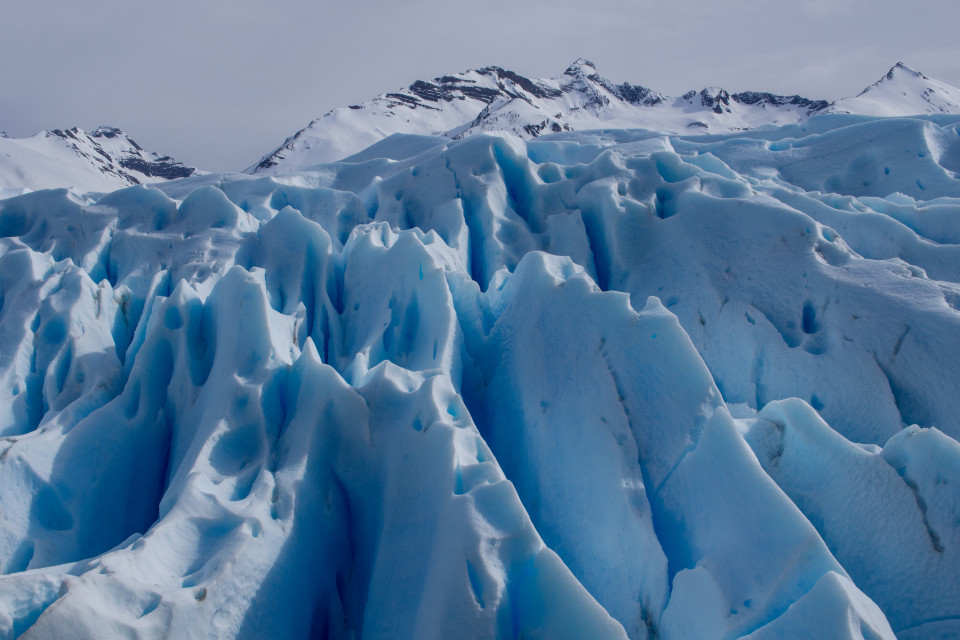
Interesting shapes and textures in the ice

Skirting the glacier towards the crampon station

The ants go marching one by one, hurrah, hurrah

Walking into the ice tunnel, avoiding the cold, cold water at the bottom

Inside the tunnel, mostly blue light

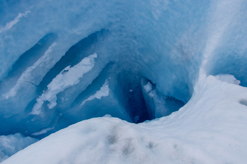
Moulin. A pit to the bottom. Watch out!

Peering over the edge
I returned to my hotel after the glacier walk to do some planning. Maps out, google tabs up, what was next? The weather was definitely changing for the worse in the surrounding area. This definitely took Torres del Paine off the list. On the other hand, the forecast for the area around the volcanoes, especially Lanin, was still looking to improve by the end of the week. The hope of getting to the top of Lanin this trip was not lost. I contacted Paul and we made a plan. I was going to drive back towards Bariloche/San Martin and we’d meet up and go for it.
I met up that evening with Jacob and Conny after dinner. I said goodbye over a beer and headed back to pack my gear for a reasonably early start. I had a lot of distance to cover.
Drive back North
From Calafate, the drive back to Bariloche was over 1400KM. Jacob and Conny stayed behind in Calafate so it would be my longest solo drive of the trip. Looking at the maps it didn’t seem like there was an optimal town to sleep in and I wasn’t really up for camping at the side of the road alone. Perito Morino (small town, not the glacier) was a bit too close and Esquel was rather far. I decided to push for Esquel. It would be a little under 1200KM in one day; this was going to be a long one. I’d have to crank the iPod, caffeinate, and enjoy some internal dialogue.
I started off in a downpour but gradually the weather improved as I made my way north. My first fuel stop was at Tres Lagos. It was definitely living up to ‘windiest gas station’ this time around. I opened the door to get out and the handle was almost ripped out of my hand; the poor flag was fluttering frantically in the gale. Back in the car and on the gravel road I could feel the wind pushing against the car’s direction of travel. Once the sun was out, I made occasional stops to take some pics and capture the feeling of southern route 40. I encountered many critters along the way. I tried to take some pics but they didn’t really work without a telephoto zoom. Horses, sheep, birds, hares, armadillos ( armadillos are adorable). I also passed quite a number of squished critters. Animals here seem to lack a fear of pavement or maybe they’re just a bit too emo. In the BC wilderness I can’t recall seeing so many animals chilling on the road or dashing across right at the moment the one car per hour drives by.

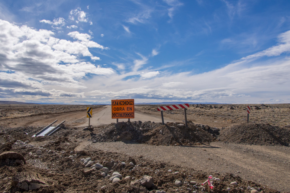
One of many construction detours on Route 40

Another

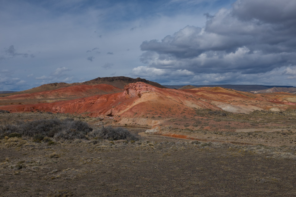
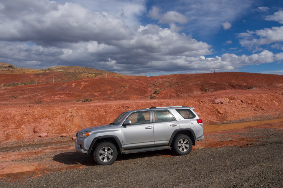
Red clay
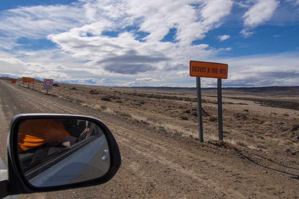
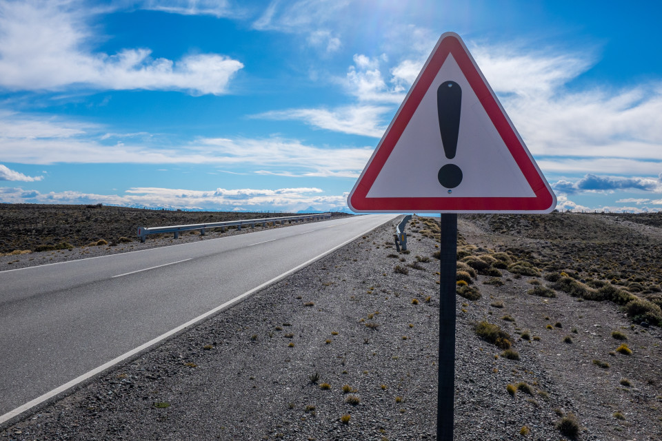
One thing that had baffled me on the drive down were frequent exclamation mark signs with no accompanying text or other signage. It would be like someone yelling an incomprehensible warning with great urgency and no information whatsoever. At some point I just started ignoring them. Like never cry wolf, once you slow down for a few and see nothing, and then start blasting by them at 140 with no consequence, they lose all relevance. On the other hand, there were some interesting ‘features’ on the road that launched me skyward with no warning signs whatsoever. Lovely! I took a moment to take a picture of a particularly useless one on the return.

WHAT!?
By the time I was past the first stretch of gravel, the wind had switched to my side/rear. Seemingly endless stretches of smoothly paved road were occasionally broken up by large sweeping turns. The end of the highway was lost in a heat shimmer. Vehicles far ahead looked like ghosts hovering on the lake of asphalt. The features at the side of the road blended into sameness and I lost all sense perspective on my speed. I was only reminded if I glanced down at the speedometer — 150, 160, 170+ — in a 4Runner. I probably should have slowed, but I didn’t. I knew this wouldn’t last; I would blast past this serene stretch of bliss soon enough and be tossed back on to the worst stretch of the route.
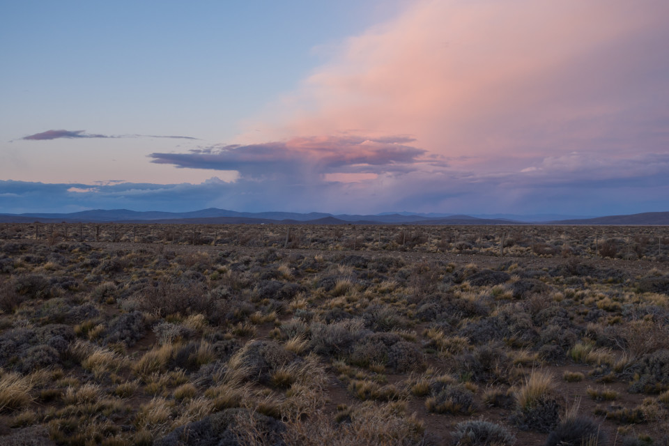
Sure enough, bliss ended. I was once again fighting ruts, potholes, loose dirt. This time around it felt like this part of the highway lasted an eternity. The sun was setting and I still hadn’t made it back to pavement. I stopped right after the sun parted ways with me to take a picture of its light caught by a storm cloud. A quick stretch of my tired hands and I was back to it; I was still several hours from Esquel.

Sunset and storm clouds
That day of driving finally ended at 10PM. A little under 13 straight hours. Ugh. I was mentally drained. I dragged my gear into a hotel, managed to grab dinner just as one of the few open restaurants was closing, and passed out. The next day was much more pleasant. By comparison the drive from Esquel, through El Bolson, to Bariloche was paved and much shorter.
I rolled into Bariloche early afternoon and relaxed. I met up with Paul that evening at Alto el Fuego, the best steak restaurant of the trip. Tomorrow we were off for San Martin to prep for a two day ascent of Lanin!
Last two blogs contain the most amazing photographs ever. Wow, life back home will be boring after this adventure of a lifetime. Mom
Pretty amazing photos Ross! It looks like a wonderful trip! I especially like the ‘!’ photo with clear blue skies in the background (that’s pretty funny, I might have to borrow that one 🙂 ) and those of the awesome glaciers. Hope to catch up with you soon, Brandon